
Gilbert Park helps a fellow motorboater to take his own boat to the Channel Islands of Jersey and Guernsey, and gets a lesson in the perils of bodged electronic navigation settings
After a season of cruising his new Nordstar 42 in The Solent with me, my friend Ahmet was keen to advance his seamanship and electronic navigation skills with an extended voyage.
In October we both had a weekend free. Ahmet had expressed a wish to go to the Channel Islands, he wanted to take on the responsibilities of being master in charge of his vessel.
The passage planning started as soon as we agreed to go. The 10-day forecast looked good, but we studied the Windy and Passage Weather websites every day in the build-up, to check that the various models stayed in agreement.
Closer to our departure date, the Met Office’s extended outlook for Niton, along with inshore and shipping forecasts, were also monitored.
We also made sure that the paperwork was ready, including familiarity with the Border Force reporting form. As some of the alternative ports were in France we had to be prepared for that.
As well as a passport, we needed the small ship’s registration document, ship’s radio licence and insurance document.
One person on board needs to have the International Certificate of Competence and VHF operator’s licence. A red ensign is required to identify the boat as British. And a Q flag should be carried, along with the courtesy ensigns for the ports to be visited. Fortunately, I already had these.
We also had a sealed envelope on board with our medical details, just in case one of us became ill.
Tidal focus

Leaving Lymington early in the morning gave us a wonderful view of the Needles
This trip was mostly about tides. We identified tidal gates for the Needles, the Alderney Race and the sill for St Helier Marina on the first day.
Ahmet, who is a whizz with an Excel spreadsheet, produced one that allowed us to put in a time for leaving Lymington that then had the periods for the gates and these were coloured green when we were in a safe period.
We decided to depart from Lymington, in case the weather changed and made the crossing difficult.
We arrived there on Thursday night, from the boat’s base in Northney, Hayling Island (37 miles), in time for dinner at our favourite Indian restaurant Rivazz.
Friday morning dawned a beautiful day, but the red sky was a little concerning. My anxiety was heightened when I looked at the BBC weather and found a hurricane was forecast!
Although the forecast was later well-publicised as being completely wrong, it might not have been so obvious had it only been out by 20mph.
This is a great example of why I use wonderful weather forecasting apps but I still check them with a forecast written by a human.
Both the Shipping Forecast and the two inshore forecasts were good and at 0800 we slipped our lines.
Leaving harbour, we did a wide open throttle test – if something was going to break now was the time. All was OK so it was time to start the RYA SafeTrx app that informed our shore contacts we had begun, where we were going and what time to worry!
Next, we gave a passage plan to Solent Coastguard, calling them up on Ch16 and asking for a working channel (Ch67).
Shipping lanes and electronic navigation

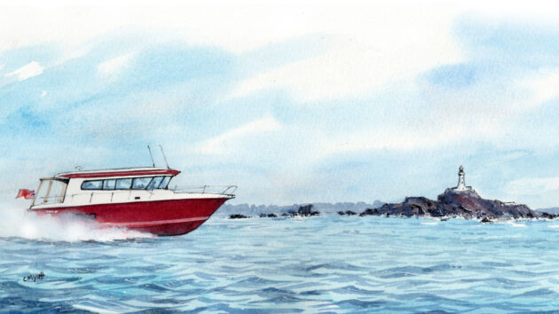
We knew we were entering the Alderney Race when we were abeam of the lighthouse at Cap de la Hague and Alderney
Once past the Isle of Wight, we settled down to enjoy the ride. The sea was calm and coffee was served, along with a biscuit or two.
Crossing the traffic zones gave us the chance to explore using radar, automatic identification system (AIS) was familiar already.
The main advantage on this trip was to use the mini-automatic radar plotting aid (MARPA) which locks onto a target and will show direction as well as the closest point of approach (CPA) and time to closest approach (TCA).
Although these are available from the AIS data some pleasure vessels (as well as warships) may not have this but should show up on radar.
In the distance, we saw the Cap de la Hague lighthouse and then Alderney and we knew we were in the Race. We had arrived at exactly the right moment – slack water.
We even saw the current arrows on the chart plotter change direction as we entered.
Apart from the odd bump at the start, the Race was remarkably calm.
The French coast passed us by quickly, and all the phones and tablets plus the Garmin auto guidance changed to French time causing momentary confusion about our estimated time of arrival.
As we got near to Jersey we found out this area is not just about tides but also rocks. They stick up out of the sea like teeth waiting to bite the unwary.
The night before we’d studied the route provided by using the autoroute function and I couldn’t understand why it was suggesting we went close to a rocky shore that dries!
We avoided it and went outside of it.
The next day it had us going in between a big rock and the lighthouse, we ignored that route as well.

Electronic navigation: The auto routing on the Garmin chart plotter wanted to take us through the rocky coast. Once the error in the settings was discovered the reason for this became clear
On our return, I contacted Garmin and discovered that the auto guidance depth of the boat was set to zero metres! The factory default is 3m and at some time it had been changed to 0m.
The autorouting function therefore assumed we needed no water to go over drying areas. Readers might like to check their own settings in any auto guidance system from time to time.
Interestingly, it also transpired that the rubber cover for the screen has strong magnets in it and when stored near the instrument pod it upset the electronic compass (installed in the pod) giving a false heading.
We arrived at St Helier, Jersey, to find it was almost full and we had to moor next to a much bigger motorboat called Starship.
There were both 16A and 32A connectors for electricity and knowing this I’d brought my adapter for the larger one.
The log for that day showed we had travelled 108 miles and this had taken 5 hours and 20 minutes.

Moored up in St Peter Port, Guernsey. You can’t see them but all the correct flags are flying, courtesy, Q and red ensign
Guernsey bound
After dinner in the nearby former abattoir, we had an early night ready for the next day.
When we awoke it was raining and had been all night. After a relaxed start, it was off to Guernsey. Again a nice, calm day and soon St Peter Port was visible. Diesel is inexpensive here (89p/lt) so we took the opportunity to fill up.
The harbour master found us a nice mooring on G pontoon (furthest from the road and the pedestrian crossing).
A walk around town to the market and tea and cake at Gracies, next to the market, and it was back to the boat. We had travelled 26 miles in 1 hour and 20 minutes.
My wife had offered to cook a Sunday roast for us at 7pm, so we had to be back for that.
Looking at the sill times it would be touch and go since we were now at afternoon tides. So, as we walked back we discussed a night crossing.
If we crossed the marina sill at 0530 we’d have enough water and be back in time to fuel the boat, have lunch, wash the boat, go home for a nap and then have dinner, plus Ahmet would get some experience of a night crossing.

Rations for the night crossing. Lots of short-term energy-producing foods
One of the things you do need for a night crossing is snacks. A trip to the Co-op provided biscuits, chocolate and the like. Most of which we didn’t eat.
The time before dinner in 17 The Pier was filled by writing a pilotage plan for the various lights and preparing the boat (cleaning the windows and the like). Another light dinner and an early night.
We crossed the sill with 2m of water under the keel and off we went. Speed was kept down in the dark period and after seeing the dawn behind Alderney we were able to open the throttles.
There were many more big boats, and we did have to avoid one by going astern of her.
The sea was moderate halfway across the Channel, however soon the Isle Of Wight was visible and then West Pole marking the start of Chichester Harbour and the last leg.
Soon we were back in Northney to do our jobs. We’d travelled on that day 107 miles in 6h 30min and in total 278 miles.
Ahmet’s reflections from his first channel crossing

Gorey Castle, on the south coast of Jersey, stands overlooking the rocky coast
It’s all about weather and navigation:
- As a beginner, I don’t want to be above Force 3 or 4, or wave heights of much more than 1m. I found Windy (online or via the app) to be the best guide for this, plus Passage Weather (online only), and the BBC/Met Office forecasts.
- Old hands may be able to navigate by beacons, and even the stars, but I know my limitations and rely on GPS. But I do ‘gross error’ checks, for instance, ‘is that headland where it should be on the multifunction device (MFD)?’ and always take a back-up in case my MFD fails – I have Navionics on my phone and iPad.
- My Garmin rubber MFD cover contains magnets and needs to be stowed well away from the electronic compass, or it can interfere with the compass reading and play havoc with the GPS system.
- Crossing the shipping channels was straightforward; if in doubt, slow down and go behind any big ship. Of more concern are the narrows on both sides of Alderney: The Race (between Alderney and France) and The Swinge (between Alderney and Burhou). Both can be tricky so time your passage correctly using Reeds, or The Channel Pilot (an essential guide). If in doubt, you can always opt to go west of Burhou, and avoid both The Swinge and the Race.
- If you’re going to St Peter Port or St Helier you also need to check when the tidal gates are accessible, so you can get in and out. Add those times to your route planning.
My departure checklist

Moored up in Jersey next to Starship. No Captain Kirk was seen
- Boat checks (engine; all filters including generator; water in the tanks; water in windscreen washers)
- Correct flags?
- Notify Border Force (24-2 hours before departure)
- Send SafeTrx (app) notification
- Notify the coastguard of the passage plans: when leaving the UK or Channel Islands (not France) call the coastguard on Ch16 to request working channel; then change to that channel. When prompted say: “wish to file a passage plan for … MMSI ….., Call Sign……; A to B, …. persons on board, ETA …., details on SafeTrx”. The coastguard will ask that you notify them when you’ve arrived. So, on arrival ask the local coastguard to notify (eg) Solent Coastguard of your arrival
- We started our return journey from Guernsey at night. I learned the importance of having a torch with a powerful beam – not just an iPhone torch or a headband torch. That torch, and a back-up, need to be fully charged the day before and then placed where you can easily get them. A good marine torch might cost upwards of £50 but that is probably no more than your diesel cost for 10-20 miles!
- At night you need to be able to dim your MFD. So, check you know how to do that (you can’t rely on the auto-dim feature to darken it enough). If you have other non-dimmable instruments, then a cloth might be useful to cover them if they are too bright. Also, adjust your MFD so en-route navigation lights are not static but flash on screen, as that may help you identify them in the dark.
- When you depart at night, go very slowly through the port and double-check your GPS is 100% accurate and that your autopilot is also 100% accurate. You will be relying on them.
- I often suffer from travel sickness, so I took over-the-counter pills before we left. As the ‘driver’ you’ll be concentrating on the passage and looking at the horizon, both of which reduce the chances of being sick. Dry biscuits, such as digestives, are a useful companion – I avoid chocolate or sweet biscuits. If your passengers get worried about seasickness beforehand, remember that there are lots of ferries to and from the Channel Islands. So, they could meet you there.
- Stabilisers are a real help. I’m fortunate to have a boat that has both Humphree interceptors and a Seakeeper gyro system. Both worked excellently. In particular, the Seakeeper makes a significant difference to the sideways movement of the boat (especially at low speeds). It is expensive (mine was £75,000) but it does a fantastic job and is highly recommended – even if you are not prone to seasickness.
- My boat, a Nordstar 42, performed excellently. It is a robust boat, designed for the tough climate of Finland, but it is also comfortable and has a nice, high-quality interior. I can unashamedly say the boat is far better suited to a trip of this sort than me. It has a top speed of about 39 knots, but in a Force 3-4 I didn’t want to go faster than 20-22 knots because it was too bumpy, especially as my passenger doesn’t have a suspension seat. Even in my suspension seat, I found that speed to be fast enough. Another lesson learned: a suspension seat is worth it.
Expert response

The Channel Isles are not just about tides but also rocks. Here they appear like rotting teeth waiting to bite the unwary
Paul Bryans, chairman of the Royal Institute of Navigation’s Small Craft Group, responds: Gilbert is to be commended for taking a sensible and cautious approach to this trip and especially the steps he took to check (and avoid) what the electronic navigation system autoroute function was suggesting.
However, his report highlights several issues which are very useful learning points on navigation generally and the use of electronic navigation systems in particular.
The first is never to rely on one source of information, however reliable it has proved in the past, or beguiling the system may be.
Next is to constantly monitor progress, by all available means, once underway and be prepared to change the plan if the situation changes or is different from what you expected (e.g. rougher sea state).
Automatic routing functions should always be treated with great care, does the system know about the tidal streams? and does it have a weather feed to predict the sea state?
We cannot simply assume the plotter will do all the “navigation” for us, it is merely one navigation aid on board, and the skipper (the master) is always responsible for navigating the vessel from berth to berth.
Modern electronics are great and remove a lot of the drudgery of position fixing and tidal heights etc. but they must be set up carefully with the correct vessel data and time zone etc – always make sure that, in particular when crossing the channel, that your tidal information matches what you might be reading about for crossing a marina cill (French or UK time but also summertime adjustments?).

The exit from St Helier with the depth over the sill being shown on the digital board
There are plenty of pitfalls to avoid, so do you know exactly how your system has been set and did your crew (or the electronic navigation system) change the time zone, to be helpful, when you weren’t looking?
The need to update electronic charts should not be overlooked, apps usually have a good value subscription service so update your ‘phone or tablet before you leave home (to use as backups) but when did you last update the charts on your plotter?
Rocks may not move but their charted positions may be corrected, and sand and shingle bars can change quite dramatically from season to season with the buoys marking the channel being relocated as a result.
Do you have suitable publications on board?
An up-to-date paper chart of a suitable scale is always worth having and consulting. It is also an electronics free backup. They are much larger than a plotter screen, so give an excellent overview for passage planning purposes.
Without electronic aids would you consider using the route suggested in the example shown?
The Imray chart of the area off La Corbière shows hazards and potential overfalls which are either not clear or not shown on the electronic chart image. Reading the RCCPF cruising guide (see note below) would put anyone off attempting the inner route in anything other than a calm conditions and daylight.
Having the Channel Pilot available is excellent, but it covers a larger area so may not have as much detail as the more focused local publication.
Unless you are currently (or very recently have been) studying an RYA shorebased navigation course, you are unlikely to have received any training on how to use electronic navigation systems.
The RIN “Electronic Navigation Systems – Guidance for safe use on leisure vessels” is available as a free download from the RIN website; it is currently being updated (and it is surprising how much needs updating after only a few years) but provides clear information on how systems work and should be used.
Electronic navigation systems used on leisure vessels (the charts and display systems) are not currently approved for navigation by any official body; that does not make them unsafe, but it does mean that they can have limitations and should be used with care – always exercise caution and do a sense check; and, in particular, keep a good lookout.
Paul Bryans is chair of the Small Craft Group of the Royal Institute of Navigation, which is leading the PVNSWG report on electronic navigation systems for the MCA, working closely with the Royal Yachting Association (RYA), Cruising Association (CA) and other experts. He is also chair of the Royal Cruising Club Pilotage Foundation which publishes the “Channel Islands, Cherbourg Peninsula and North Brittany” cruising guide and is an RYA Yachtmaster examiner.
From dinghy sailing to the ARC Channel Islands Rally
Former dinghy sailors Judy and Jon Hilton bought a yacht last October and will be using the ARC Channel Islands…

Smoothing the cruising – a buyers guide to ‘shock-absorbing’ boat gear and more!
The ability to soften that slamming motion of a fast boat at sea has been greatly helped with more advanced…
Basic survival celestial navigation
Making a ‘mer pass’ observation is one of the simplest, yet most useful navigation tools for sailors to possess, explains…

Blind navigation: how to find your way in restricted visibility
Is blind navigation a foggy notion for Yachtmasters, or a useful seamanship skill? PBO investigates
Want to read more seamanship articles?

A subscription to Practical Boat Owner magazine costs around 40% less than the cover price.
Print and digital editions are available through Magazines Direct – where you can also find the latest deals.
PBO is packed with information to help you get the most from boat ownership – whether sail or power.
-
-
-
- Take your DIY skills to the next level with trusted advice on boat maintenance and repairs
- Impartial in-depth gear reviews
- Practical cruising tips for making the most of your time afloat
-
-
Follow us on Facebook, Instagram, TikTok and Twitter