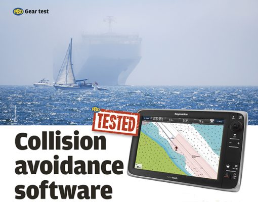
Ben Meakins puts Raymarine’s new Lighthouse AIS update through its paces in Southampton Water
AIS has arguably added more to the safety of small boats amongst shipping than any other development in the past few decades.
The only drawback is that any AIS display requires the user to perform some mental calculations to work out whether any particular target will cause a problem or not.
Raymarine has attempted to take AIS to the next level with its new Lighthouse R17 software release for its chart plotters.
It’s all very well to be able to see vessel data and positions, but working out how that affects you is a case of examining the data in more detail – speed, course, CPA (closest point of approach) and TCPA (time to closest point of approach) – and making a judgement based on these as to how close you’ll come and what avoiding action to take, if any.
The new software update has a few features. Firstly, the vessel icon now reflects the type of vessel. Big ships are shown as large blocky icons; high-speed vessels are shown with a visible wake, and sailing vessels have a ‘teardrop’ shape.
But where things get really interesting is in what they call ‘target interception’.
This tracks AIS targets in relation to your own COG and SOG, displaying ‘interception zones’ on the plotter. These show the danger areas, displaying a suggested clearance zone around the target’s projected location.
Targets making under 2 knots SOG are shown with a ring around them.

1. Target interception zone (predicted area of danger based
on target’s last reported position)
2. Target COG line
3. AIS target (last received position)

In practice, this means that a large pink box appears on the chart plotter’s screen, into which you should not stray. You can set the parameters for these zones on a set-up screen: we set it to display interception zones for AIS targets crossing our course up to 2NM ahead.
Crossing ships

In this screenshot, there are two targets which both the human eye and the plotter’s software marked as dangerous. One, a yacht motoring south-east, and the other a powerboat heading north-west. If we are to hold our course, the first (A) will pass astern – but only just.
The second (B) is more of a problem. The software thinks that should we maintain our current course and speed, we will be in danger of a collision.

We maintain our speed but alter course to port: we will still pass ahead of the first vessel (if still a little close for comfort) but will be able to pass astern of the second, should current speed and heading be maintained.

We found the projected areas remarkably accurate. In the case of the Red Funnel ferry above, we aimed for the aft edge of the interception zone (still well in front of the AIS target) and passed safely close behind the ferry.
Overtaking ships

Here, we are motoring down Southampton Water with another vessel (a motoring yacht) at around the same speed. You can see the interception zone ahead of the yacht (A) – we should be fine here unless we speed up.
But behind us you can see a large target, an approaching car transporter (B). This is not yet easily visible to the naked eye, but the large interception zone is well visible: the vessel is doing around 13 knots at this point.

Zoomed out, you can see the large target, some distance away, that the software deems a threat (circled).

Here, around four minutes later, you can see the AIS target has crept up on the screen (A). Without the large interception zone displayed, it wouldn’t have been as noticeable on the chart and it would have been some time before we had spotted it as a threat. Another one can be seen behind us. (B)
Faster vessels

In some instances, two interception zones are shown. This occurs when a faster vessel is approaching, and shows the areas in which you may be in danger should you alter course. Here, the second interception zone (shown as the one furthest from your vessel) warns that you may be at risk of being run down from behind. This will be of particular use if you’re trying to cross ahead of a ship that is going faster than you – the software will soon warn you should that be a foolish move.
PBO verdict
Firstly, as the manual is at pains to point out, this is by no means a replacement for the human eye – and keeping a good lookout will more often than not show these interactions with shipping in good time. Where it is particularly useful is in crowded waters where it can be difficult to judge the speed and intentions of other vessels – shipping lanes and busy ports, for instance.
In particular, it would be a great help when crossing the Channel, where ships and yachts have miles of empty sea in which to set up a collision from miles out. These zones will warn of a collision risk at an early enough stage to be able to make the necessary course alterations.
We found it particularly useful as an early warning of other vessels. The pink interception zones were an excellent warning that there were ships on the move, and coming up at a rate of knots, that would have taken some finding with the naked eye at that long range.
In crossing shipping lanes (Southampton Water provided a suitably busy arena for us) the software was useful, showing where we were safely crossing the lanes and where we would be better passing behind ships. The zones proved surprisingly accurate, allowing us to alter course to pass behind a ship from a few minutes out.
The new features help to take the computing of AIS data a stage further and offer a novel way of presenting it on screen to help avoid a collision. It’s well worth a look if you’re in the market for a new plotter, or if you can apply this free upgrade to your existing one.
As published in the Summer 2016 issue of PBO. To search the PBO archives for more practical articles and gear tests visit our online copy shop.
The great UK antifouling test for cruising yachts
20 antifouling paints tested in 13 UK locations: which works best where you keep your boat?
Antifouling: Everything you need to know
Here’s PBO’s guide to preparing for, choosing and using antifouling paints
Best forward-looking sonar: 5 units tested
How effective is forward-looking sonar at flagging up shoals and obstacles on the seabed? David Pugh compares the findings from…
Testing times on the Atlantic Rally for Cruisers (ARC)
Laura Hodgetts talks to the skippers of 20 boats on the Atlantic Rally for Cruisers (ARC), ‘the biggest downwind gear…
6 Lifebuoy Lights tested
With the advent of cheaper LEDs, a number of new lifebuoy lights have appeared on the market. On a dark…
14 iPad and Android navigation apps tested
Gear test following an explosion in the number of marine navigation apps available for iPad and Android devices in the…
How to test an old VHF antenna and cable
A reader's question about testing a VHF antenna and coaxial cable answered by one of PBO's experts
Pontos four-speed winches
A range of four-speed winches from Pontos is claimed to offer more speed for race boats and more power for…


